


Transforming Landscapes into Actionable Data for Diverse Industries

Point Cloud Classification For Accurate DTM Generation
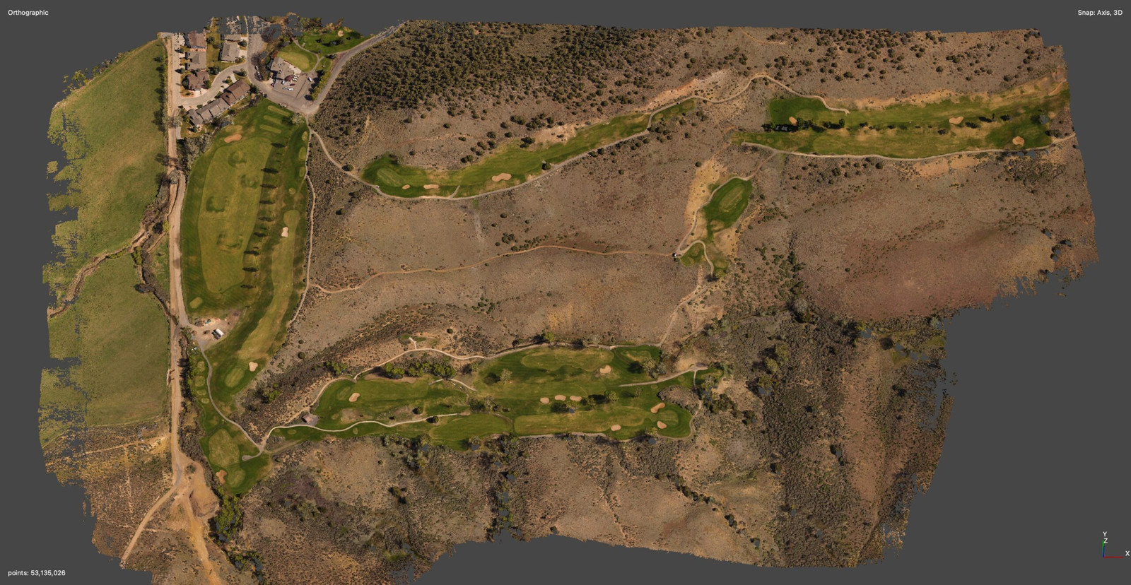
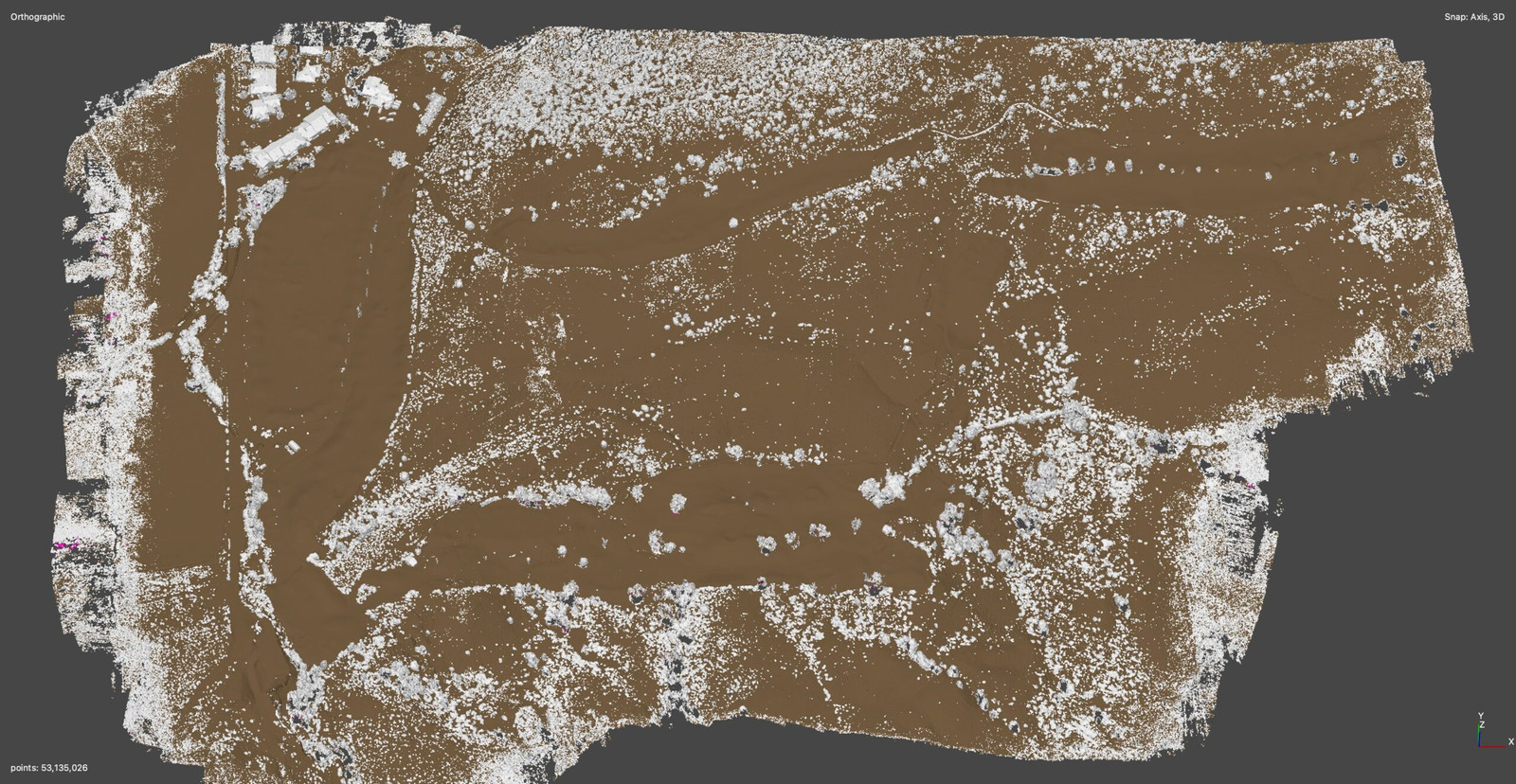
Point classification processing on dense point clouds is an invaluable tool for companies because it streamlines the analysis and interpretation of complex spatial data. By distinguishing ground points from other elements, such as buildings and vegetation, it provides a clean base map essential for various applications, including urban planning, infrastructure development, and environmental management. This processed data helps in reducing time and costs associated with manual data sorting, enhancing the efficiency of project planning and execution. Companies value this technology for its ability to provide detailed, accurate topographical information, supporting better decision-making and project outcomes across multiple industries.
Digital Terrain Models with Contours
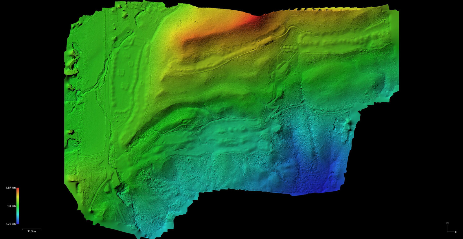
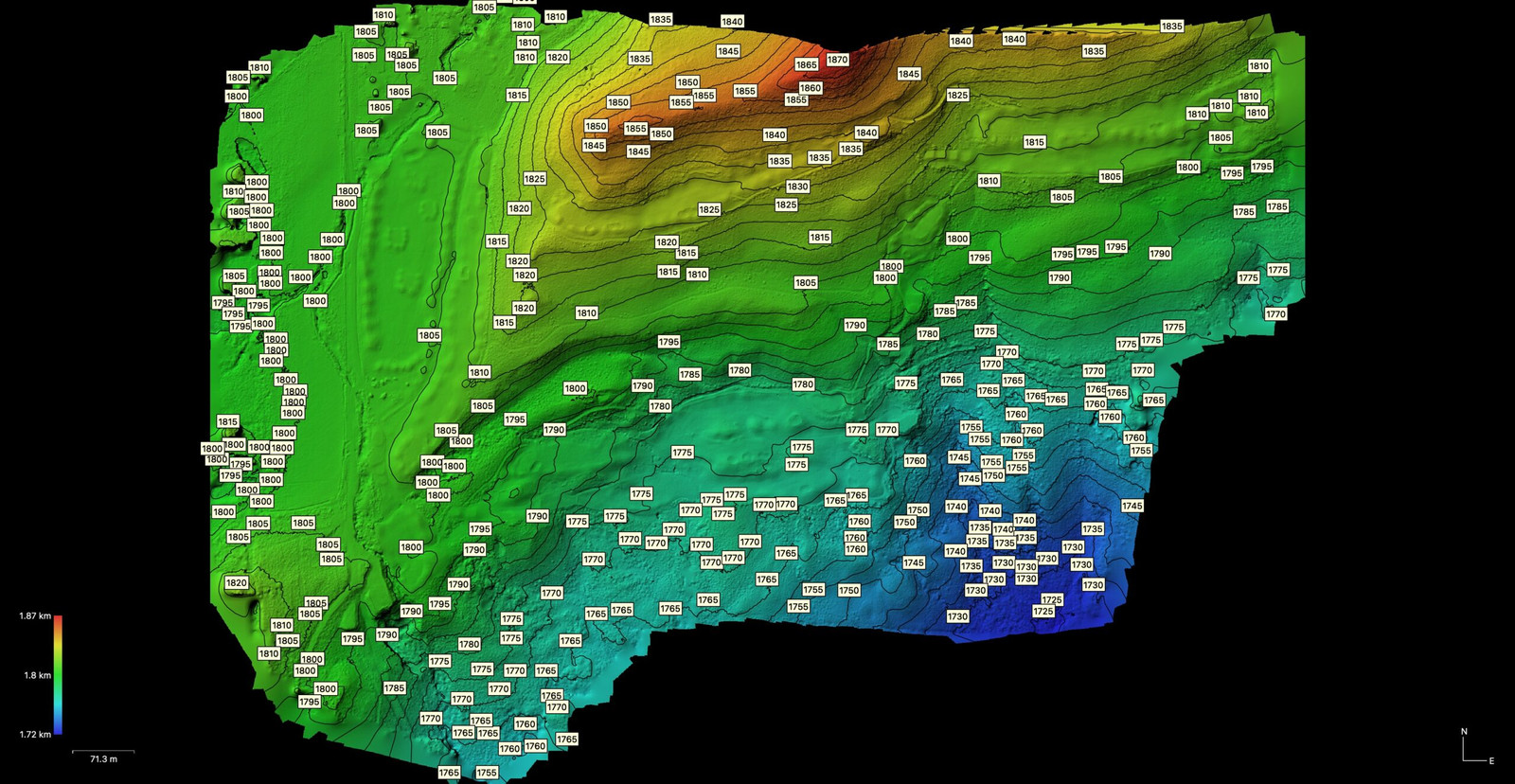
Digital Terrain Models (DTMs) with contour lines provide a visual and quantitative representation of the land’s surface shape, allowing companies to understand the topography of a site without being physically present. These models are crucial for planning and decision-making in construction, environmental management, and urban development, as they help in identifying elevation changes, landform gradients, and potential drainage patterns. The contour lines add an extra layer of detail, making it easier to visualize and interpret the terrain, facilitating the design of infrastructure projects, land use planning, and risk assessment for flood or erosion control. Companies value DTMs for their precision in representing the earth’s surface, enabling more informed and efficient project planning and environmental conservation efforts.